We welcome you to the official site of the Research Station of the Russian Academy of Sciences in Bishkek city.
Federal State Budget Institution of Science Research Station of the Russian Academy of Sciences in Bishkek city is the research organization subordinated to the Ministry of Science and Higher Education of the Russia Federation.
The Research Station of RAS engages 57 scientific workers, including 26 researchers, 2 Doctors of Sciences and 8 Candidates of Sciences among them. The overall staff amounts 133 employees.

Address
![]()
720049, Kyrgyzstan.
Bishkek-49, Research Station RAS.
Phone: +996 (312) 613-140
Fax: +996 (312) 611-459
Director

Anatoly Kuzmich Rybin
Doctor of Science
in Physics and Mathematics
e-mail: rybin@gdirc.ru
Happy Russia Day!
Wednesday, 11 June 2025 12:42


The national holiday of the Russian Federation has been celebrated annually since 1992 to commemorate the adoption of the Declaration of State Sovereignty of the Russian Soviet Federative Socialist Republic (RSFSR) on 12 June 1990.
Last Updated on Wednesday, 11 June 2025 12:44
Celebration of the 80th Anniversary of Victory in the Great Patriotic War
Wednesday, 14 May 2025 15:00
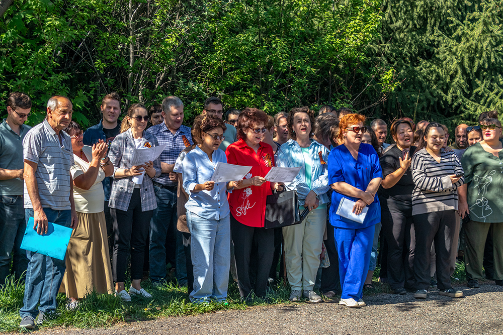
On May 7-8-9, 2025, the staff of the Research Station of the Russian Academy of Sciences in Bishkek city (RS RAS) solemnly celebrated the 80th anniversary of Victory in the Great Patriotic War!
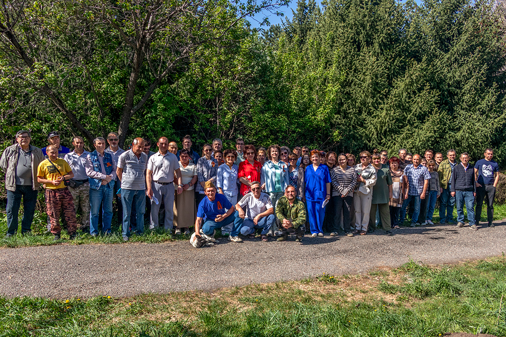
In honor of this significant date, we jointly created a Garden of Memory on the territory of the Scientific Station: we purchased 50 seedlings of fruit trees, planted them, and installed a memorial plaque. A ceremonial meeting was held on this occasion, which was attended by almost all the employees.
The deputy director gave a speech about the upcoming holiday and the events held and thanked everyone for their active participation in the festive events. Together we happily sang "Katyusha", perhaps the most beloved song of war time. All the planted seedlings - apple trees, pears, cherries have already sprouted.
Last Updated on Wednesday, 14 May 2025 15:09
XVII International Conference of Young Scientists and Students "Modern Equipment and Technologies in Scientific Research" - 2025
Tuesday, 06 May 2025 14:57
Last Updated on Tuesday, 06 May 2025 15:08
International scientific seminar within the framework of international Project RSF-DST No. 24-47-02016 implementation
Wednesday, 09 April 2025 13:35
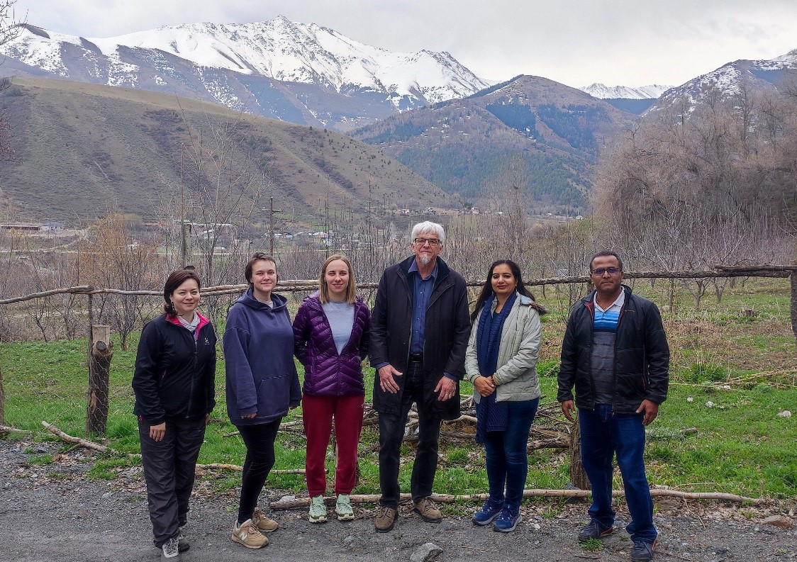
From March, 31 to April, 11, 2025, an international scientific seminar is being held at the Research Station of the Russian Academy of Sciences in Bishkek cith (RS RAS) as a part of joint international project RSF-DST No. 24-47-02016 "Deep geoelectric structure of the Shillong plateau and adjacent seismically active areas (northeastern India) based on magnetotelluric data". The purpose of the seminar is to discuss the scientific results and field data of magnetotelluric studies obtained during the project in 2024 and in the first quarter of 2025.
The seminar is attended by Russian and Indian geophysicists representing the Center for Geoelectromagnetic Research of the Institute of Physics of the Earth of the Russian Academy of Sciences - a branch of the Schmidt Institute of Physics of the Earth of the Russian Academy of Sciences (CGEMI IPE RAS, Moscow, Russia), the Research Station of the Russian Academy of Sciences in Bishkek (RS RAS, Bishkek, Kyrgyzstan) and the National Geophysical Research Institute of the Council of Scientific and Industrial Research (CSIR-NGRI) Hyderabad, India).
The seminar included sessions at which the main executors of the joint Russian-Indian project RSF-DST No. 24-47-02016 "Deep geoelectric structure of the Shillong plateau and adjacent seismically active territories (NE India) based on magnetotelluric sounding data" made a reports: Dr. A. Rybin, PhD candidate A. Ionicheva, PhD candidate T. Rodina, PhD candidate K. Nepeina, Dr. Devi А. and Mr. Babu N.
The participants of the RSF-DST project presented the results obtained during its implementation on the collection, processing and analysis of field magnetotelluric sounding data in the Shillong plateau study area (northeastern India), as well as preliminary results of the analysis of magnetotelluric monitoring records carried out in the Northern Tien Shan territory.
The employees of the Laboratory of Deep Magnetotelluric Studies of RS RAS took an active part in the seminar. During the seminar, master classes were held on the organization of field measurements and modern methods of processing and analyzing field geophysical materials. The participants of the seminar had the opportunity to present their approaches and results of processing and analyzing magnetotelluric data. Two field excursions were also held: a visit to the magnetotelluric monitoring point of the RS RAS "Aksu" (Head DMTS D. Chernenko) and a visit to the regime geophysical station of the RAS NS "Kegety".
The seminar became an important platform for the exchange of experience and knowledge between Russian and Indian scientists, for training and advanced training of young researchers from our countries. We thank all the participants of the seminar for interesting reports and speeches, fruitful and informal discussion of the issues considered, which gives a small but real contribution to the development of international scientific cooperation!
Last Updated on Wednesday, 09 April 2025 13:56
XVII International Conference of Young Scientists and Students "MODERN EQUIPMENT AND TECHNOLOGIES IN SCIENTIFIC RESEARCH"
Thursday, 13 March 2025 11:36
Dear colleagues!
We would like to remind you that the XVII International Conference of Young Scientists and Students "MODERN TECHNOLOGIES AND TECHNOLOGIES IN SCIENTIFIC RESEARCH" (http://mmk.gdirc.kg/ ) will be held on April 23-25, 2025 at the Scientific Station of the Russian Academy of Sciences in Bishkek. Due to numerous requests received by the Organizing Committee, the deadline for accepting applications for participation in the Conference has been extended until March 24, 2025.
Requirements for the design of materials
Feedback from the Scientific Advisor
Registration for the Conference is carried out only through the website http://mmk.gdirc.kg/ in the section "Registration".
!!! Students, graduate students and young scientists under the age of 39 are invited to participate in the Conference.
!!! Participation in the Conference is free.
Last Updated on Thursday, 13 March 2025 11:39

XVII International Conference of Young Scientists and Students "MODERN EQUIPMENT AND TECHNOLOGIES IN SCIENTIFIC RESEARCH"
Tuesday, 11 February 2025 13:13
Dear colleagues!
On April 23-25, 2025, the XVII International Conference of Young Scientists and Students "MODERN EQUIPMENT AND TECHNOLOGIES IN SCIENTIFIC RESEARCH" will be held at the Research Station of Russian Academy of Sciences in Bishkek (http://mmk.gdirc.kg/).

THEME OF THE CONFERENCE:
Section "Integrated geological and geophysical studies of seismically active regions" includes reports on methods and new software systems used to monitor the geoenvironment and ionosphere, and on the results of their application, as well as reports on various kinds of geoinformation systems.
Section "Natural and technogenic hazards" includes reports on the prevalence and features of manifestations of seismotectonic processes, landslides and mudflows in Central Asia. The same section also presents reports on man-made hazards associated with the operation of reservoirs and mining in seismically hazardous areas.
Section "Interdisciplinary reports" is divided into two subsections:
"Mechanics" - includes reports on solving complex and dynamic problems in various areas of modern mechanics;
"Interdisciplinary reports" - includes reports on the formulation and solution of problems of mathematical modeling of physical, economic and other processes, as well as on modern methods and technologies used in the processing of various kinds of data.
WORKING REGIME OF THE CONFERENCE:
GYBRID FORMAT: oral (online) and poster (offline) reports
CONFERENCE GOALS:
- raising the level of scientific research and expanding the scientific horizons of young scientists, specialists, graduate students, undergraduates and students;
- integration of science and education;
- development of creative activity of young researchers;
- popularization of scientific research conducted at the Research Station of the Russian Academy of Sciences.
PUBLICATION OF THE BOOK OF MATERIALS is expected in autumn 2025. The collection of materials of the Conference is registered with the Book Chamber of the Kyrgyz Republic, and is also indexed in the information and analytical system of the RSCI (https://elibrary.ru/).
Requirements for the design of materials
Feedback from the Scientific Advisor
!!! Students, graduate students and young scientists under the age of 39 are invited to participate in the Conference.
!!! Participation in the Conference is free.
Last Updated on Tuesday, 11 February 2025 13:14
More Articles...
Page 1 of 26
Projects
Scientific divisions
Science
Photogallery


