


On the 12th of September, 2015, at the meeting of Committee of Plenipotentiaries of Governments of the Russian Federation and the Kyrgyz Republic, which was held on the basis of IRS-GPG, the Scientific Program “Geodynamics and Geoenvironmental Problems of High-Mountain Tien Shan (2015-2019)” was approved. In implementation of specific chapters of the Program within the frames of independent projects the international and national scientific and research organizations and establishments, as well as individual researchers and specialist from countries – members of IRC-GPG and not, can take part.
A large number of researchers and specialist from Russia, Kyrgyzstan, Kazakhstan, Tajikistan, Uzbekistan, Germany, France, China and Japan took part in development of the Program.
It is proposed to finance the projects by means of:
- Target financing by the founding members of IRC-GPG due to budgetary financing allocated by ministries and departments of the countries – members of IRS-GPG for science and techniques development;
- Financial means received under the agreements and contracts;
- Financial benefits from use of intellectual property of IRC-GPG;
- Grants and financial means received under charity.
The Scientific Advisor of the Program “Geodynamics and Geoenvironmental Problems of High-Mountain Tien Shan (2015-2019)” is an Academician N.P. Laverov.
The organization of projects implementation within the framework of Program was rested on Executive Direction of IRC-GPG.
On the basis of contemporary knowledge and facilities available there are necessity and possibility to continue the researches of the following interconnected problems of geodynamics of the Central Asia.
- Geodynamics of latest intracontinental mountain building;
- Stressed and deformed state and deep structure of Tien Shan;
- Seismotectonic, geoenvironmental and engineering-geological aspects of latest tectonics and modern geodynamics of Tien Shan.
The team of scientists from Russia and Kyrgyzstan headed by the Academician N.P.Laverov developed the Scientific Program of IRC-GPG “Geodynamics and Geoenvironmental Problems of High-Mountain Tien Shan (2000-2005)”. The Program was approved at the meeting of the Committee of Plenipotentiaries and was successfully implemented. On the 13th of 2007, the Program of Research Activities for 2006-2011 was approved. The Program provides for researches in the following directions:
- Geodynamics of latest intracontinental mountain building;
- Stressed and deformed state and deep structure of Tien Shan;
- Seismotectonic, geoenvironmental and engineering-geological aspects of latest tectonics and modern geodynamics of Tien Shan.
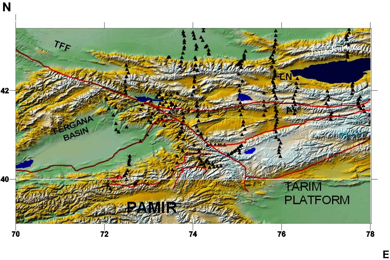
During the Center’s operation, we have created a real geodynamic polygon at the territory of Tien Shan covering Kyrgyzstan, Uzbekistan, Kazakhstan and some adjacent territories. This a unique polygon in the world due to a complex of methods used to study geodynamics of the Earth’s crust. In 2007 we installed the GPS network at the territory of Pamir (Tajikistan). We have concluded the agreements on scientific and technical collaboration and now we are conducting joint works together with a large number of research organizations of Kyrgyzstan, Russia, scientific centers of Kazakhstan, Uzbekistan, China, USA, Canada, and Germany. The most active participants and scientific partners of IRC-GPG for the reported period were the following institutes and organizations:
- Institute of Geology, National Academy of Sciences of the Kyrgyz Republic;
- Institute of Seismology, National Academy of Sciences of the Kyrgyz Republic;
- Institute of Physics and Mechanics of Rocks, National Academy of Sciences of the Kyrgyz Republic;
- State Agency of Geology and Mineral Resources of the Government of the Kyrgyz Republic;
- Geological Institute, Russian Academy of Sciences;
- Institute of Oceanology, Russian Academy of Sciences;
- Moscow State University
- Institute for High Temperatures-Association, Russian Academy of Sciences;
- Geophysical Center, Russian Academy of Sciences;
- Institute of Geophysics, Siberian Branch of the Russian Academy of Sciences;
- Institute of Geophysics, Ural Branch of the Russian Academy of Sciences
- Institute of Geoecology, Russian Academy of Sciences;
- Schmidt Institute of the Physics of the Earth, Russian Academy of Sciences;
- Institute of Seismology, Ministry of Education and Science, Republic Kazakhstan;
- Scientific-Manufacturing Co. "Prognoz", Kazselezaschita, Agency of Extreme Situations of Republic of Kazakhstan
- Institute of Seismology, Academy of Sciences of Republic of Uzbekistan;
- National University of Uzbekistan;
- University of Oregon (US);
- Massachsetts Institute of Technology (US);
- Central Washington University (US);
- Institute of Geophysics and Planetary Physics, University of California, San Diego (US);
- University of California, Riverside (US);
- Rensselaer Polytechnic Institute (US);
- Seismological Bureau of Xinxiang Uygur Autonomous Region, China “Phoenix Geophysics Ltd.”, Toronto, Canada
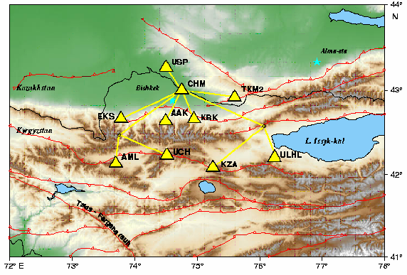
Presently, the IRC-GPG scientific infrastructure provides the successful implementation of a complex of scientific, research and organizational activities including organization and support of the Kyrgyz seismic network (KNET), creation and development of GPS network, electromagnetic and seismological monitoring, deep studies of the Earth’s crust and many other research projects carried out within the frameworks of IRC-GPG Research Programs.
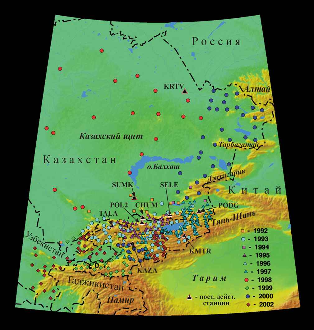
We successfully implement the project within the frames of Agreement between IRIS (USA) and the Research Station RAS on ensuring the operations of KNET telemetric network. The output of information from the network of seismological stations after its modernization in 1998 makes up no less than 97%. Seismological data are transferred in a real-time mode to Russia (Special Control Service of the Ministry of Defense of Russia), USA (IRIS Data Center), Kazakhstan (National Nuclear Center) and Kyrgyzstan. Since 2006, some partial data are transferred to the Seismological Bureau of Xinjiang Uygur Autonomous Region (China).


