


Study of India-Eurasia convergence zone in Pamir and adjacent territories using GPS kinematics
Within the frameworks of the quadripartite agreement about scientific and technical collaboration, researchers from GPS laboratory participate in realization of the international project on conducting collaborative geodynamic studies in the region of Pamir - Tien Shan mountain junction and Tajik Depression located in Tajikistan and Kyrgyzstan. The project provides for implementation of the Program of the International Research Center – Geodynamic Proving Ground (IRC-GPG) “Geodynamics, Geoecology and Environmental Problems of High-Mountain TIen Shan” as well as for development of international scientific cooperation for solution of fundamental problems of modern geodynamics of continental lithosphere.
Project participants:
- Research Station of the Russian Academy of Sciences (RS RAS) in Bishkek, Kyrgyz Republic;
- Institute of Earthquake Engineering and Seismology (IEES), Academy of Sciences of Republic of Tajikistan;
- Montana State University, USA;
- Colorado State University, USA.
Project objectives:
- To receive reliable and qualitative data on kinematics of India-Eurasia convergence zone through Pamir and adjacent territories;
- To install geodynamic network of GPS measurements in Tajikistan;
- To clarify the nature and type of tectonic movements in this region, their spatio-temporal distribution.
Condition of works:
The project is supported by the National Science Foundation, USA. The US party provides scientific equipment for geodynamic studies; provides necessary software for data processing and analysis; participates in the field works. The staff of RS RAS and IEES conduct a major part of GPS network installation; provide and conduct field measurements in Kyrgyzstan and Tajikistan. The project participants make regular exchanges of information about work progress; they exchange field materials and results of processing and interpretation, conduct trainings for the staff on techniques of field works and data processing.
Terms of project realization: 1st of January 2007 – 31st of December, 2011.
Results of works:
In 2007-2008, 37 regional and 3 permanent sites were installed in Tajikistan; 5 regional and 1 permanent sites were installed in Kyrgyzstan (see fig.). During this period, all of the new 42 regional sites of Tajik GPS network received a complete cycle of measurements. In 2009, 20 regional sites in Tajikistan and 5 sites in Kyrgyzstan were measured. Moreover, 10 old sites of Central Asian GPS network in Batken Region of Kyrgyzstan were measured.
To receive linear velocity vectors of movement of sites of the new Tajik GPS network, all of its sites need to be measured at least three times throughout 3-5 years.
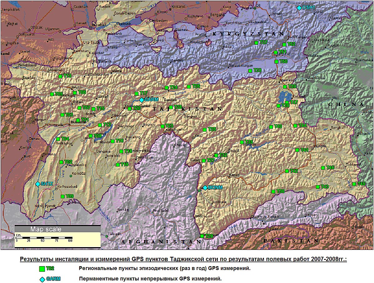
Location of the installed and measured regional and permanent GPS sites of Tajik GPS network.


