
According to the results of scientific research works of 2015 for a large part of the territory of the Central Tien Shan there was obtained general correlation in the distribution velocity of the summary horizontal deformation on GPS and seismologic data for the observation period 1998-2014.
At that, the reduced velocities of near-surface dilatancy and increase in deformation velocities in seismic active layer of the Earth’s crust were fixed in area of Mountains Jumgal-Too (Fig. 1).
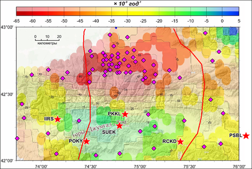
Figure 1. The distribution of total horizontal deformation velocity (dilatancy) for the near-surface part of the Earth’s crust according to GPS data.
Within the framework of planned scientific and research works on July, 2016, the GPS Laboratory staff have installed 6 new GPS sites (stars) for particularization of the deformation anomaly in this region (Fig. 2).
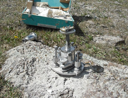
Figure 2. New GPS mark that installed on the Karakol Pass ~3500 m.
All marks of new GPS sites we plan will to measure in this year, and repeated measurements on one of the marks of each site will be annually included in the GPS campaign.
Last Updated on Friday, 26 August 2016 08:50