21.09.2023
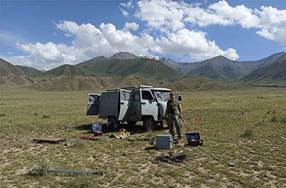
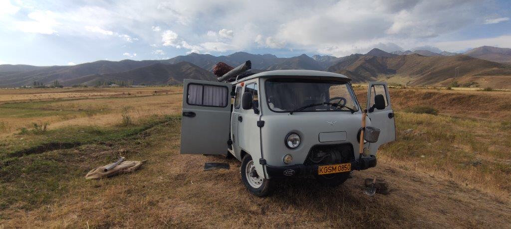
From August 29 to September 4, 2023, Group of Magnetotelluric soundings (GMTS) carried out monitoring observations on the territory of the Bishkek Geodynamic Proving Ground. This observations have been carried out since 2012. The observations covered the “East”, “West” and “Center” profiles in the area of Norus village. Using the Phoenix MTU-5 and MTU-5A measuring systems, the MTS group consisting of three teams carried out deep magnetotelluric sounding (DMS) work at three points, on the “East” profile at observation point E14, on the “West” profile at observation point W00 and on the “Center” profile at observation point C6, where the duration of registration of MT field in the GMT mode at each point was about 110 hours.
The start of work was preceded by calibration of recorders and sensors of MT stations. The testing of the measuring systems involved in these works for the identity of MT-field registration was carried out at point C6. To assess the level of interference and parameter settings for recording the work recording, a control recording lasting at least 40 minutes was preceded. The orientation of previous of the measuring installations completely repeated the previous deployments.
03.05.2023
Numerical fitting of MTS calibration curves by fractional calculus fitting
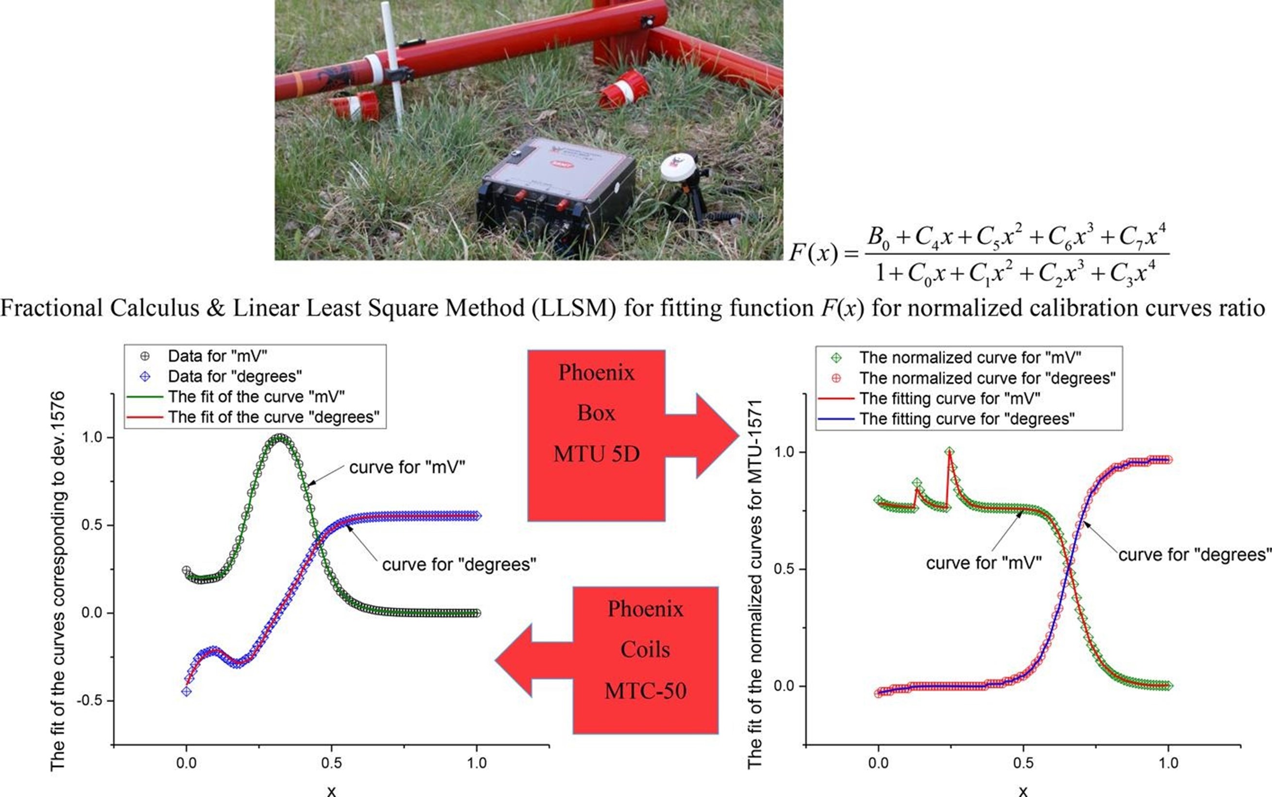
The article «Quality control of the initial magnetotelluric data: Analysis of calibration curves using a fitting function represented by the ratio of 4th-order polynomials» (Nigmatullin R.R.; Bataleva E.A.; Nepeina K.S.; Matiukov V.E.) was prepared in the Laboratory of Deep Magnetotelluric Investigations (LDMI) and published by Measurement journal of first quartile, indexed in Web of Science. The research has been conducted conducted under the state assignment of Research Station RAS and Project «Priority 2030».
A personalized URL link provides 50 days' free access to the article before June 20, 2023:
https://authors.elsevier.com/a/1g-nbxsQaMHTn
Nigmatullin R.R.; Bataleva E.A.; Nepeina K.S.; Matiukov V.E. Quality control of the initial magnetotelluric data: analysis of calibration curves using a fitting function represented by the ratio of 4th-order polynomials // Measurement, 2023, 216, 112914, https://doi.org/10.1016/j.measurement.2023.112914.
Highlights:
- Universal fractional calculus fitting curve enables to fit 4 normalized calibration curves.
- The standard deviation between the tested box and the pattern box in average is at least than 1%.
- The calibration curves identity proves the high quality of field data in mountainous conditions.
- The pair of “amplitudes” and “degrees” – 4 calibration curves in total, are observed with the fitting function as two polynomials ratio of fourth degree function F(x) containing 9 fitting parameters (C0-7, B0), simply calculated as numeric constants through linear least squares method (LLSM).
- The relative error evaluating the fitting 9 parameters (C0-7, B0) is less than 0.25%.
- Routine calibration process could be used as an etalon searching in the normalized form.
- The fitting parameter D demonstrates “a quality” of calibration of the tested box compared with the reference one.
29.10.2021
In the period from August 24 to September 08, the MTS Group consisting of 4 brigades carried out work on two profiles in the Kochkor district of Naryn region, Ukok-2 and Chon-Tuz. On the profile "Ukok-2", which is located south of Kochkorka village, team No. 1 and team No. 2 carried out work on magnetotelluric sounding (MTS) at 11 points. At 10 observation points, the duration of the MT field registration in the MTS mode was 16-18 hours, at the FT21 observation point in the DMTS mode, the duration of observations was about 300 hours.

The work was carried out using Phoenix MTU-5 measuring complexes in the normal registration mode. The start of work was preceded by calibrations of recorders and sensors of MT stations. In all observation points, a control recording of at least 40 minutes was preceded to assess the level of interference and the settings of the parameters for recording the working record. The electrical components of MT field were measured using measuring devices with electric dipoles 50 m. long. The magnetic field components were measured using MTC-50 induction sensors. At all sounding points, the grounding of the dipoles was carried out using non-polarizing electrodes, the grounding of dipoles was carried out on the principle of “sensor to sensor” with previous years of observations. The orientations of measuring installations at these points completely repeated the previous deployments.
Also, at this time, seismic fields were recorded at the FT21 observation point using an installed gradient seismic installation.
Upon completion of main work on Ukok-2 profile, in the area of FT15 observation point (MTS), team No. 4, using the Skala 48 multielectrode station, carried out 24-hour monitoring in amount of 36 registrations, the duration of each 42-44 minutes by electrotomography and induced polarization methods, the type of installation was “Schlumberger”.
On the profile "Chon-Tuz", which is located south of Tuz village, team No. 3 carried out work on magnetotelluric sounding in AMTS mode at 15 observation points, where the duration of registration averaged 1 hour. The work was carried out using the Phoenix MTU-5A measuring complex in normal registration mode. The beginning of work was preceded by calibrations of MT station recorders and sensors. In all observation points, a control record was preceded to assess the level of interference and the settings of parameters of working record. The electrical components of MT field were measured using measuring devices with electric dipoles 50 m. long. The magnetic field components were measured using MTC-30 induction sensors. At all sounding points, the grounding of dipoles was carried out using non-polarizing electrodes.
The team No. 4 on "Chon-Tuz" profile carried out the work by electrotomography methods and induced polarization using the multielectrode station "Skala 48". Data registration was performed by two types of installation: "Schlumberger" and "Venner". The station was operated using two multi-electrode cables, the length of each connecting cable is 120 m, the installation of electrodes was carried out in increments of 5 meters, the total number of electrodes when deploying two connecting cables is 48 pieces. The length of work site is approximately 3600 m, registration was carried out at 29 base observation points.
Upon completion of main work on the profile, in the area of FT18 point (MTS), work was carried out on 24-hour monitoring in the amount of 35 registrations, the duration of each was 42-44 minutes by electrotomography and induced polarization methods, the type of installation was “Schlumberger”.
07.10.2021
An article entitled «VOLUMETRIC AND SPATIAL SEGMENTATION OF THE TIEN SHAN LITHOSPHERE ACCORDING TO GEOPHYSICAL DATA» by the research team of the authors of the Laboratory of Deep Magnetotelluric Research of the RS RAS (Rybin A.K., Bataleva E.A., Nepeina K.S., Matyukov V.E.) is published in the scientific journal «Geodynamics & Tectonophysics», indexed by the international Scopus database of the third quartile (Q3).
The geological and geophysical materials on the deep structure of the crust and upper mantle of the Central Tien Shan were collected and analyzed under Project 16-17-10059 supported by the Russian Science Foundation. For the comprehensive analysis of geological and geophysical information, the data on the Northern Tien Shan were prepared under the state assignment of the Research Station RAS in Bishkek for 2019–2021, which was funded by the RF Ministry of Science and Higher Education (project АААА-А19-119020190063-2).
The full text of the article can be found on the journal's website https://www.gt-crust.ru/jour/article/view/1238
Rybin A.K., Bataleva E.A., Nepeina K.S., Matyukov V.E. VOLUMETRIC AND SPATIAL SEGMENTATION OF THE TIEN SHAN LITHOSPHERE ACCORDING TO GEOPHYSICAL DATA. Geodynamics & Tectonophysics. 2021;12(3):508-543. (In Russ.) https://doi.org/10.5800/GT-2021-12-3-0537
ABSTRACT
This article consolidates the results of studying the deep structure of the lithosphere of the Central Tien Shan, which aimed to identify the main tectonic elements in its geophysical models. We have compared the structural and geological data with the information on the deep structure obtained by geophysical methods and from the positions of earthquake hypocenters in the study area. According to geological concepts, the Tien Shan orogenic belt is characterized by longitudinal and transverse segmentation. The boundaries of the Northern, Middle, Southern Western and Eastern segments of the Tien Shan are deep-seated fault structures. In deep faults and channels of heat and mass transfer, endogenous processes are localized. High-velocity, geoelectrical and thermal models consider such faults and channels as contrasting objects that can be referred to as indicators of these processes.
Our analysis of the locations of earthquake hypocenters from NNC, KNET, CAIIG, KRNET, SOME catalogues shows that seismic events are strongly confined to the fault zones and the boundaries of large blocks. A correlation between the anomalies of geophysical fields suggests the degree of inheritance of tectonic structures and the boundaries of the main tectonic segments of the Tien Shan. To compare the crustal and upper mantle heterogeneities reflected in different geophysical fields, we have analyzed seismic tomographic sections based on volumetric seismotomographic models geoelectric and velocity sections along profiles across the main tectonic elements of the study area. The sections are used to identify the zones with relatively low (i.e. reduced) seismic wave velocities and detect the deep-seated longitudinal segmentation of the folded belt. Objects showing anomalous seismic wave velocities are found in the seismotomographic sections at all the depths under consideration. The most contrasting differences in the velocities of P- and S-waves are typical of the depths of 0-5 km and 50-65 km, showing the most clearly observed Northern, Southern and Western segments of the Tien Shan. In general, the velocities of P- and S-waves at the Northern Tien Shan are higher than those at the Middle and Southern segments. We have analyzed the distribution of geoelectric heterogeneities identified from magnetotelluric sounding data in order to determine the boundaries of the main tectonic elements that are considered as the zones of increased electrical conductivity confined to the boundaries of the fault structures. The distribution of earthquake epicenters clearly reflects the segmentation of the Tien Shan into the Northern, Middle and Southern segments and shows the Western and Eastern Tien Shan relative to the Talas-Fergana fault. Ourstudies of the crust and the upper mantle of the Tien Shan have confirmed that the abovementioned tectonic segments have differences in their deep structures Based on a comprehensive analysis of the study results, we can qualitatively identify a relationship between the distribution of the velocity and geoelectric heterogeneities in the crust and upper mantle, seismicity and the stress-strain state of the crust.
03.09.2020
According to the task plan of the Laboratory of Deep Magnetotelluric Studies (LDMS) from 5 to 25 of August 2020, of MTS Group in consist of three teams performed MT-soundings on 11 points of «Ukok-2» profile in the Kochkor valley of Kyrgyzstan.
At 10 points, the duration of MT-field registration at each observation point averaged 90 hours.
In point № 23, the duration of MT-field registration was about 20 days. The electrical components of the MT-field were measured with using broadband Phoenix MTU-5 complexes with electric dipoles 50 m long. The magnetic field components were measured with using of MTC-50 induction sensors. The dipoles were earthed by nonpolarizable electrodes by the “electrode to electrode” principle with previous observations at all sounding sites.