We welcome you to the official site of the Research Station of the Russian Academy of Sciences in Bishkek city.
Federal State Budget Institution of Science Research Station of the Russian Academy of Sciences in Bishkek city is the research organization subordinated to the Ministry of Science and Higher Education of the Russia Federation.
The Research Station of RAS engages 57 scientific workers, including 26 researchers, 2 Doctors of Sciences and 8 Candidates of Sciences among them. The overall staff amounts 133 employees.
Latest news
IX International Symposium “PROBLEMS OF GEODYNAMICS AND GEOECOLOGY OF INTRACONTINENTAL OROGENS”
Tuesday, 24 October 2023 11:44


IX International Symposium “PROBLEMS OF GEODYNAMICS AND GEOECOLOGY OF INTRACONTINENTAL OROGENS”
will be held at Research Station of the Russian Academy of Sciences in Bishkek city, Kyrgyz Republic, on 24 - 28 of June, 2024.
Executive organizers of Symposium:
- Research Station RAS in Bishkek, KR
- International Research Center – Geodynamic Proving Ground in Bishkek, KR
Objective of Symposium:
To discuss the state of problems and results of research in Geodynamics and Geoecology of intracontinental orogens including problems of lithosphere structure formation, development of methods, technologies and means of studying of Earth’s surface and interior, social and economic consequences of endogenous and exogenous disastrous processes.
Languages of Symposium:
Russian, English.
Regional GNSS measurements in Kyrgyzstan in 2023.
Friday, 29 September 2023 13:24
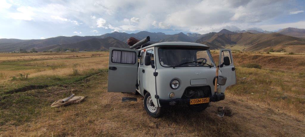
This year, the field group (GSDN) of the GPS Laboratory (LGPS), based on the Global Navigation Satellite Systems (GNSS) method, carried out planned field measurements of GNSS network sites in the Naryn and Issyk-Kul regions of Kyrgyzstan. Repeated surveys of the same GNSS sites in the study area make it possible to determine the high-precision position of the sites at the time of measurement and track the long-term rate of its displacement to solve fundamental geodynamic problems, as well as to assess the danger of living the population and other objects.
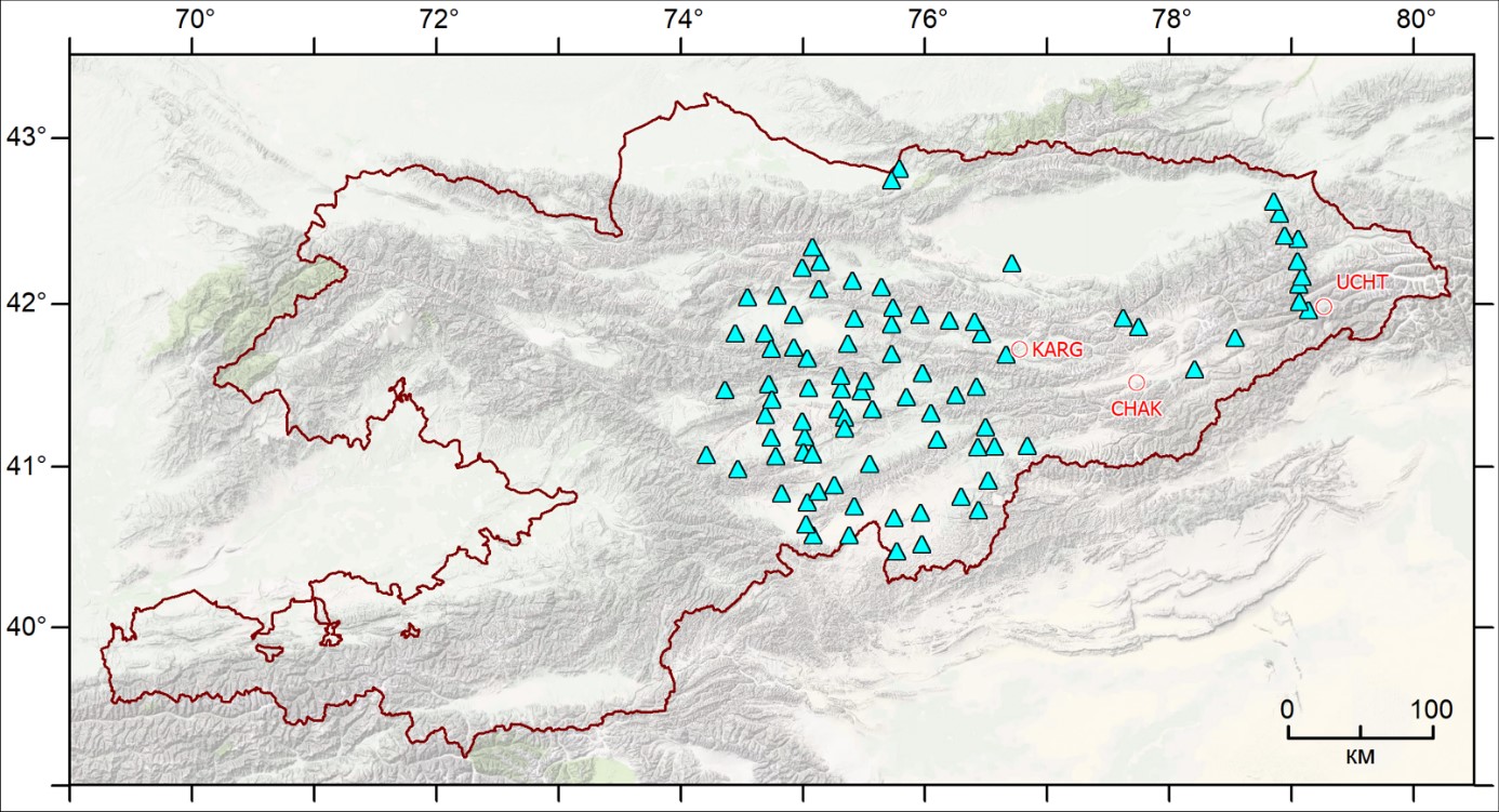
From May to September 2023, LGPS employees traditionally carried out two campaigns (KGS23a from 05/31/2023 to 06/30/2023; KGS23b from 08/09/2023 to 09/08/2023) to measure regional sites in the eastern part of Kyrgyzstan (Fig. 1).
|
Figure 1 - Regional marks where GNSS work was carried out in 2023: triangular markers - re-measured this year (89); round markers are planned but not measured sites due to the impossibility of access to them (3). |
According to the decision of the administration of the RS RAS, from March 2022, only 3 brigades can participate in field GNSS campaigns. Each team includes an operator and driver of a ZIL-131 or GAZ-33088 vehicle. During the month, each team measures 14-15 sites, 36 hours are allocated to measure each site. At the same time, the vehicle mileage during one campaign was 1688-2133 km. The average vehicle mileage between observation sites was 126 km.
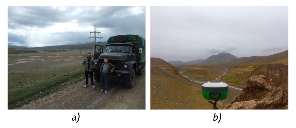
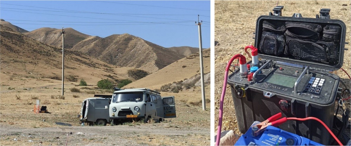
Since 2020, GSDN employees have been carrying out GNSS measurements with Russian-made MP-8 receivers, capable of recording signals from 4 satellite constellations: GPS, GLONASS, Beidou and SBAS (Fig. 2).
|
Figure 2 – Fragments of field GNSS work in 2023: a) The field team moves between regional GNSS measurement points; b) Measurement at a GNSS point with an MP-8 receiver with a rod support. |
News of RSF project №22-27-00567 implementation
Wednesday, 27 September 2023 13:39
In the "News" section of the Russian Science Foundation (RNF) website, a press release describing the electromagnetic research conducted by the staff of Research Station of the Russian Academy of Sciences in Bishkek city (RS RAS) at various sites of the Issyk-Ata fault (Kyrgyzstan) under the RSF project № 22-27-00567 was published.
Scientists in Kyrgyzstan have identified seismically dangerous areas of the active Issyk-Ata fault
Source: RSF Press office
Translation: RS RAS
Geophysicists have developed a geoelectric model that makes it possible to find areas in lithospheric faults where earthquakes are likely to occur. For this purpose, the authors studied the electrical properties of the earth's crust in the zone of 150-kilometer-long Issyk-Ata fault in Kyrgyzstan. The results of the study, supported by an RSF grant, were published in the scientific journal “Geophysics”.
Group of Magnetotelluric soundings News
Thursday, 21 September 2023 13:23
From August 29 to September 4, 2023, Group of Magnetotelluric soundings (GMTS) carried out monitoring observations on the territory of the Bishkek Geodynamic Proving Ground. This observations have been carried out since 2012. The observations covered the “East”, “West” and “Center” profiles in the area of Norus village. Using the Phoenix MTU-5 and MTU-5A measuring systems, the MTS group consisting of three teams carried out deep magnetotelluric sounding (DMS) work at three points, on the “East” profile at observation point E14, on the “West” profile at observation point W00 and on the “Center” profile at observation point C6, where the duration of registration of MT field in the GMT mode at each point was about 110 hours.
The start of work was preceded by calibration of recorders and sensors of MT stations. The testing of the measuring systems involved in these works for the identity of MT-field registration was carried out at point C6. To assess the level of interference and parameter settings for recording the work recording, a control recording lasting at least 40 minutes was preceded. The orientation of previous of the measuring installations completely repeated the previous deployments.
News of the Laboratory for Complex Research of RS RAS
Tuesday, 29 August 2023 11:56
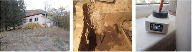
A radon indicator device RADEX MR107 was installed in the Laboratory of Complex Research, within the framework of cooperation between the Research Station of the Russian Academy of Sciences (RS RAS) and the Institute of Geophysics named after Yu.P. Bulashevich, Ural Branch of the Russian Academy of Sciences (IGP Ural Branch of the Russian Academy of Sciences) in June 2023. The installation of the sensor involves the advancement of new research using radon volumetric activity monitoring (RVA) data in conjunction with other geophysical methods used at the Research Station.
The device is located at the regime station "Issyk-Ata". In the basement, a probe and a conductive tube are installed with access to the operator's room, where a priming pump and a Radex MR107 meter are installed.
All operating modes of the device, as well as visualization and data downloading, are carried out using the official Radex Data Center software.
More Articles...
Page 3 of 34
Last news
- IX International Symposium
- Results of publication activity of staff of the Research Station of the Russian Academy of Sciences for 2023
- XVI International Youth Conference “MODERN TECNIQUE AND TECHNOLOGIES IN SCIENTIFIC RESEARCH”
- Reception of Rossotrudnichestvo in honor of the 300th Anniversary of the Russian Academy of Sciences in the Russian House in Bishkek
- IX International Symposium_First circular
Projects
Scientific divisions
Science
Photogallery


